Saturday 19 November 2022

Old Castle Lachlan and Kilmorie Chapel, Lachlan Bay, Cowal Peninsula, Argyll and Bute

Old Castle Lachlan (click/tap to enlarge)

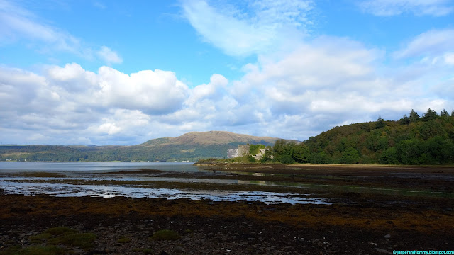
We did quite a few walks on the Cowal Peninsula back in September; you might have read my previous article on Otter Ferry or Benmore Botanic Garden. Here's another walk from the Cowal, this time covering Old Castle Lachlan and Kilmorie Chapel, Lachlan Bay, Loch Fyne. The route also incorporates a pleasant section along the coast beyond the castle. The route includes some there and back sections and in total covers 2.3 miles. The section to the castle has been much improved with a boardwalk in place. There is a little mud to contend with along the coastal section but nothing too challenging. It was an on lead walk for Jasper and Tommy though, due to various hazards: proximity to the road on the way to Kilmorie, marshland on the way to the castle and jellyfish on the coastal sections.

You'll find a link to the start location on Google Maps, along with maps of the route and GPS navigation file, at the end of the article. Information is current as of our last visit in September 2022. All images can be clicked/tapped to enlarge. More information about the walk and the area, can be found on the Lachlan Trust website here.

Our walk starts at the notable Inver Restaurant, where you'll find a large car park. From the car park you'll have immediate views of the ruin of the 15th century Old Castle Lachlan jutting out into Lachlan Bay. The castle was the home of the Maclachlan clan chiefs until the battle of Culloden in 1746 where the 17th clan chief was killed. The castle had fallen into a state of disrepair but The Lachlan Trust are raising funds to complete its conservation. Once you're done admiring the view, walk straight through the car park and along the front of the restaurant.

Our route goes through the car park and past the restaurant (click/tap to enlarge)

Continue through the outside seating area which looks like a nice place to stop off at in season 

The path then passes some lodges and into a wooded area

The boys seem to have really got the hang of sitting on benches!

We soon reach a narrow fork to the right. Rather than continuing on the boardwalk, turn off on the narrow right hand path, heading towards another car park and Kilmorie Chapel.

Continue straight along the narrow path, passing the car park on your right

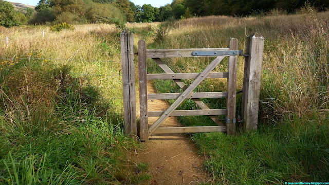
The path continues through a gate

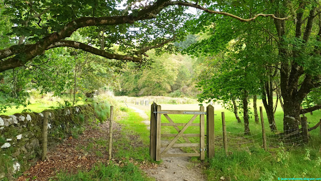
We soon reach Kilmorie Chapel, where the path turns to the right, through another gate

The ruined Kilmorie Chapel is medieval and it's where you'll find the graves of the chiefs of the Maclachlan clan, who have been buried here since the 15th century.

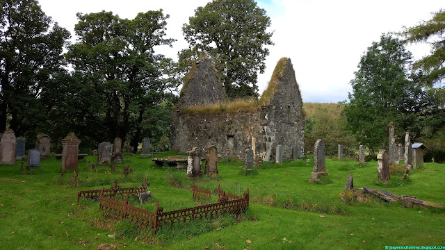
Kilmorie Chapel has many old graves surrounding it

Kilmorie Chapel and Maclachlan graves

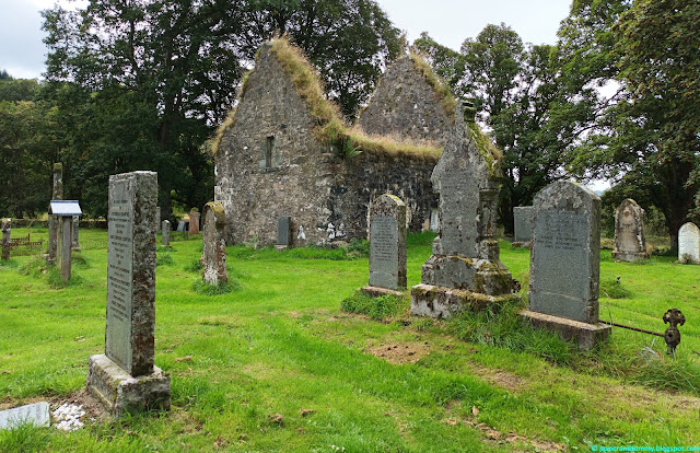
Kilmorie Chapel and graveyard

Leaving the chapel, we retrace our footsteps back through the gates, past the car park, returning to the boardwalk.

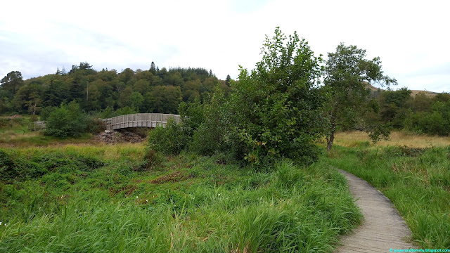
Follow the boardwalk to the right, towards the bridge

The boardwalk arrives at a bench where we have a view of the New Castle Lachlan in one direction and the Old Castle Lachlan in the other. The new castle is early 19th century and was built by the 19th Maclachlan clan chief.

Jasper and Tommy always happy to be exploring somewhere new! New Castle Lachlan can be seen behind them.

Old Castle Lachlan

New Castle Lachlan

Follow the track at the end of the boardwalk around to the left towards the old castle. A short distance further along take the left fork out to the castle itself as per below.
 
Take the path left to the old castle here

Follow the path around the left hand side of the castle where you can enter the courtyard.

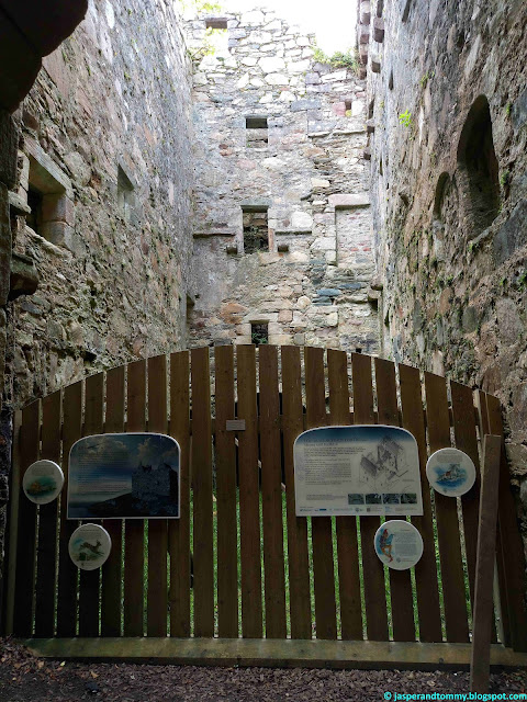
At the courtyard you'll find some interesting information panels about the castle

The path does continue around the castle on the left hand side but it's a bit precarious and I would recommend walking around the path from the right side of the castle instead.
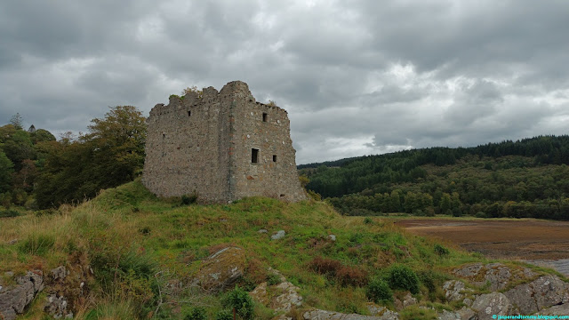
Old Castle Lachlan

There are some lovely views down Loch Fyne from the shore at the castle as you can see below.


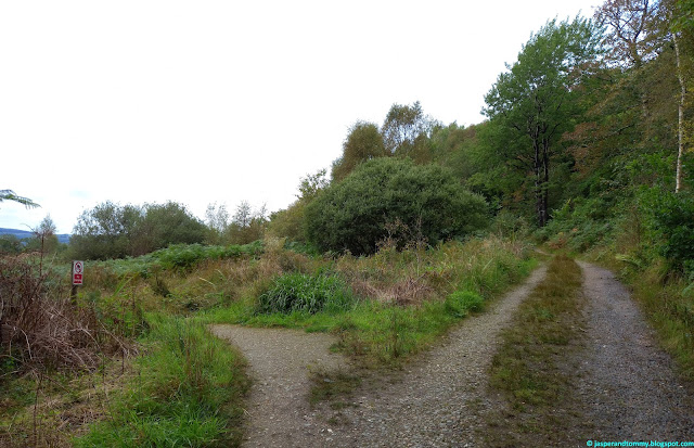
Follow the path back past the castle but continue straight on the grassy path, rather than continuing around the castle to the right, as shown in the following photo.

Take the grassy path straight on here

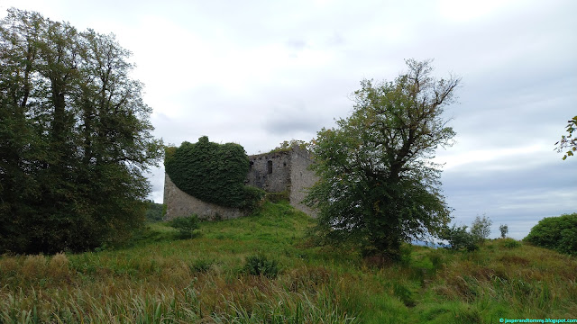
View back towards the castle

The path comes out at a T-junction. Follow the path left up the shore of Loch Fyne.

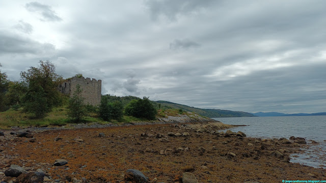
Looking back to the castle from the shore beyond

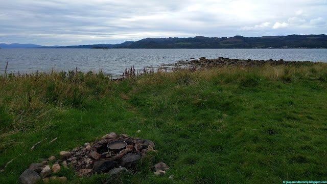
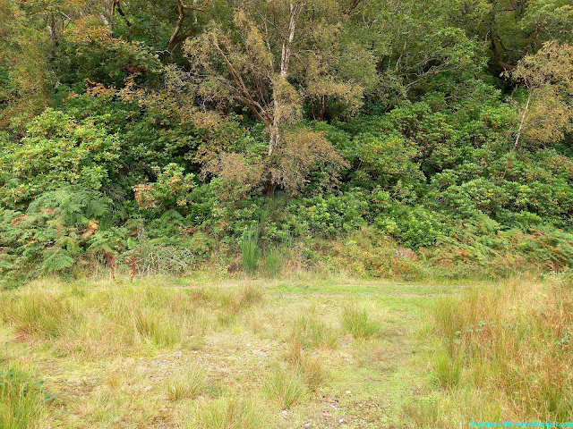
The path comes to a spot that's apparently ideal for a fry up!

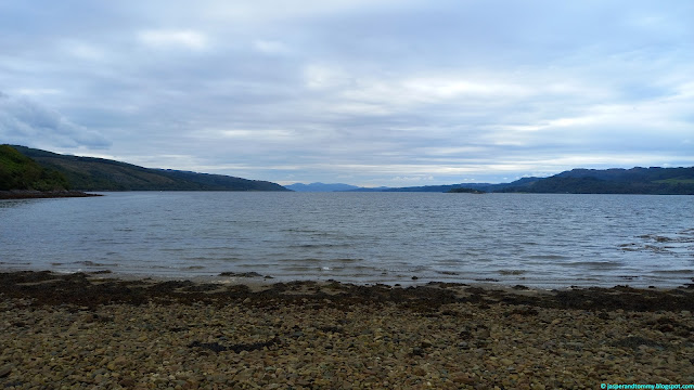
Our route ends at a rocky beach where we take in some last beautiful views of the loch

The route back to the car park at the Inver Restaurant is straight forward. Follow the route back the way we came but keep straight on the farm track to bypass the castle.

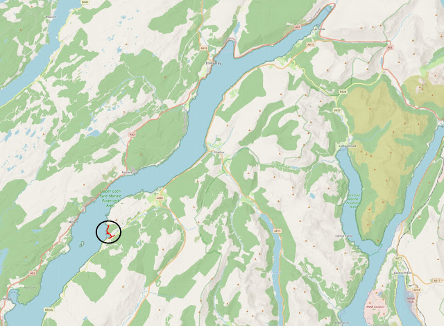
Route overview with wider surrounding area. Route shown in black circle. Click/tap to enlarge image.

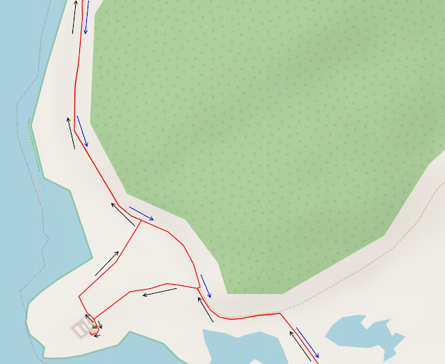
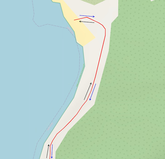
Below detailed route maps have black arrows to depict outward route and blue arrows to depict return route. Please note that the path shown out to Kilmorie Chapel and the path shown that runs from the castle to the main track are approximate as the actual paths do not exist on the map.

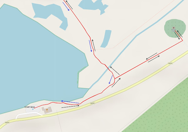
Route detail - part 1 of 3

Route detail - part 2 of 3

Route detail - part 3 of 3

NB link is to Inver Restaurant; take the right hand turn into the car park immediately after the restaurant.


PLEASE BE SURE TO READ OUR DISCLAIMER WHICH ALSO INCLUDES IMPORTANT SAFETY INFORMATION.

Sunday 13 November 2022

Devilla Forest, Kincardine, Fife (Part 2 of 2)

Tommy on the path past Peppermill Dam (click/tap to enlarge)

Here's the second part of our 6 mile Devilla Forest tour. You can find part 1 here. Maps of the full route, GPX navigation file and link to car park on Google Maps can all be found at the end of this article. All images can be clicked/tapped to enlarge them. Information is current as of our last visit in October 2022.

Picking things up from where we left in part 1, the path continues along Peppermill Dam, keeping the dam on our left hand side. Stay on this path for a little under a mile as it continues on beyond the dam and reaches a crossroads. Along the way, there's plenty of spots for the boys to have a dip!

Jasper's in the water every chance he gets! (click/tap to enlarge)

Jasper stops amid the lovely autumn colours for a quick pose!

A rare moment where we managed to capture both Tommy and Jasper standing still and posing at the same time!

View across Peppermill Dam

Jasper loving his time in the water!

The stick has lured Tommy further into the water than he normally ventures!

Once the crossroads is reached, take the track straight ahead as per photo.

Take the track straight on here

Continue on the track for just over 0.1 of a mile, until a T-junction is reached. At the T-junction, take a right as per photo below.

Turn right at the T-junction here

Follow the track for a little over 1/4 of a mile until another T-junction is reached. Turn left here (sign-posted Cycleway Coastal) as per photo.

Take the left hand turn ("Cycleway Coastal")

Continue on this track for 1/2 a mile until you reach a collection of large, distinctive stones at the right hand edge of the path.

The trees in the light of the late afternoon make a lovely backdrop for Tommy!

Jasper's always ready for another photo!

The stones on the right hand side of the track mark the path to Keir Dam, which is where we're heading as below.

Stones at the path to Keir Dam

Turn right to follow the path past the stones down to the dam

The path's a little overgrown but easy enough to negotiate

The path continues a short distance down to the dam, where we turn right to follow the dam on our left hand side.

NB if the first little path right is very muddy, you can continue straight on for a few metres and then turn right on the next path instead as per below.

Follow in Tommy's direction to the next right turn if the first right is very muddy

The path along the edge of the dam

Continue along the dam for about 1/2 mile, keeping the dam on your left. The path can be muddy in places but there are generally fairly obvious detours to circumvent the worst of it or you can at least walk around the edges of the path. The path bends to the left and follows the top of the dam until we reach a crossing with Keir Burn.

Jasper at a camp fire spot along the dam

The path meets the burn where it has been dammed and it's pretty easy to walk across the stone with a little care; there's generally just a couple of centimetres of water.

The stone crossing at Keir Burn

Continue along the path a short distance until you reach a T-junction with a main track.

Nice view of Keir Dam along the way

When you reach the T-junction, turn left along the main track as below.

Take the main track left here, ignoring Tommy who looks like he wants to go the other way!

Continue along the track for a little under 1/4 mile until you reach another T-junction. Take the right hand turn back towards the car park, as per below.

Take the right hand turn here (sign-posted Car Park)

Stick to the main track and it's just a short distance back to the car park.

Tommy and the view back up the path near the car park

Take the left through the arches, back to the car park

Before we get to the maps and navigational section, I thought I'd share a few more photos. These are photos that we've taken whilst walking some of the other many paths around the forest.


Jasper has seemingly endless energy for running around the forest!

"Really? We've stopped AGAIN? For ANOTHER photo?"

The towering Scots Pines are magnificent

Keep your eyes peeled and at this time of year, you'll see that fabulous fungi abound!


Hope you enjoyed reading the article. Here's the navigation section with the maps etc.

Route overview and surrounding area (click/tap to enlarge)

Route detail - part 1 of 7

Route detail - part 2 of 7

Route detail - part 3 of 7

Route detail - part 4 of 7

Route detail - part 5 of 7

Route detail - part 6 of 7

Route detail - part 7 of 7

Link to start location on Google Maps


PLEASE BE SURE TO READ OUR DISCLAIMER WHICH ALSO INCLUDES IMPORTANT SAFETY INFORMATION.

Popular Posts